
Finally Escalante
Upper Calf Creek Falls

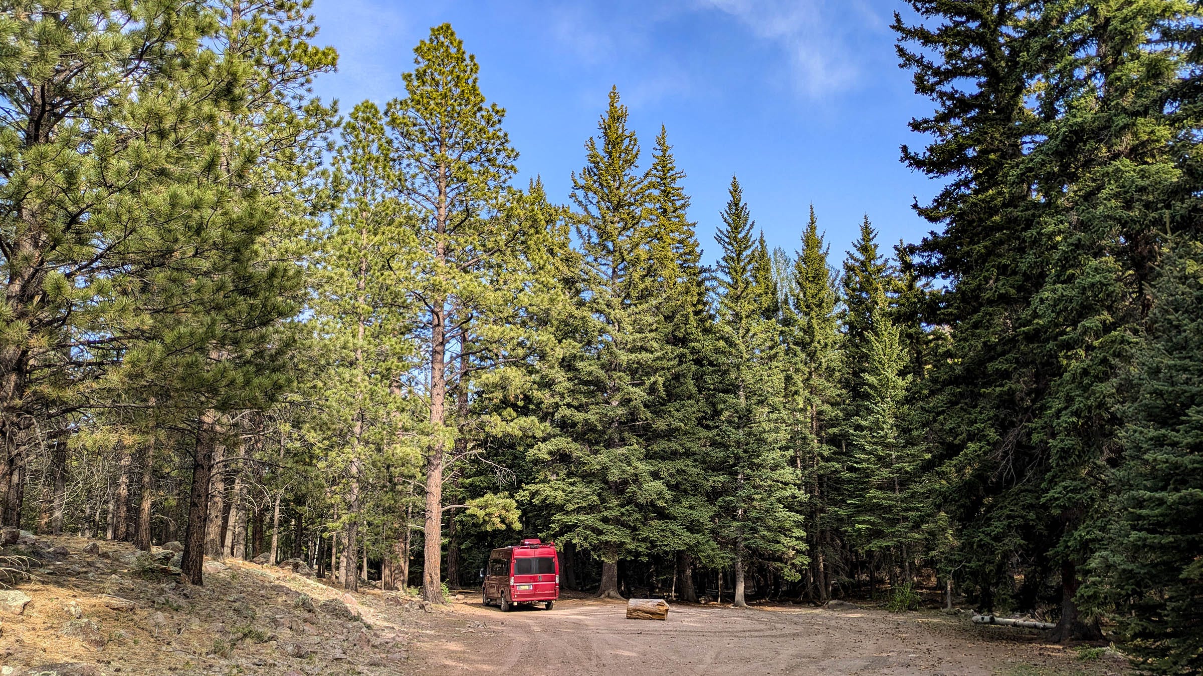
We wake up under the shade of huge Ponderosa and Douglas Fir trees in the Dixie National Forest. Sunlight filters through the highest treetops. A babbling brook supports massive trees, as well as this spring’s first population of mosquitoes, thirsty for blood. We were wise to hang out in the van last night, instead of sitting by a fire.
The pass between Torrey and Boulder, Utah, opens into large aspen meadows. A group of old, bare trees is surrounded by 4-foot-tall offspring confidently sprouting leaves. Many of the aspen stands are younger saplings. Thick gatherings of 10 to 20-foot spindly trees crowd together. It appears as if some event must have happened a while ago, perhaps a fire, perhaps a blowdown, as the oldest giants lay toppled on top of each other like pick-up sticks on the ground. Scenic view pullouts overlook miles and miles of white rock mesas, some topped with forest flats.
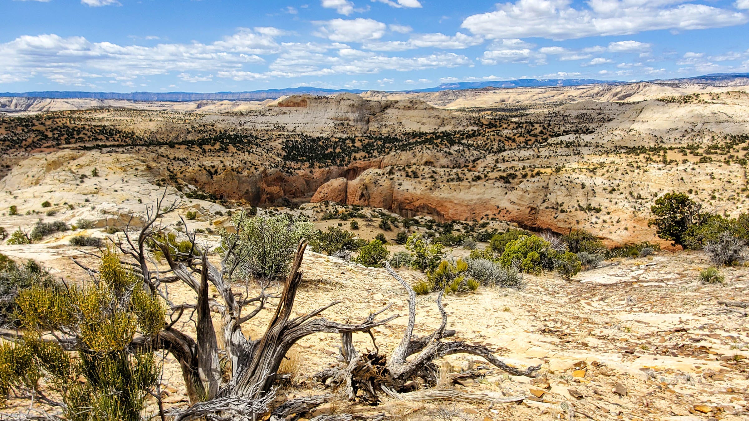
Leaving the forest behind, Highway 12 drops down to Boulder, Utah, and continues out toward slickrock country. A two-mile stretch of pavement narrows to a width of 2-way traffic. They call this a hogback. A razor-thin ridge with steep, sloped drop-offs falls several hundred feet to either side. A three-inch-high curb of asphalt edges the route as if that would keep a vehicle from plunging over the cliffs. There are no guardrails. People pull over when possible to take in breathtaking views of Jurassic-era rock. Sweeping formations of domes and combs and cliffs and solidified dunes stretch as far as you can see. The Navajo sandstone almost looks liquid with its contoured layers. I feel the planetary sense of this earth, stripped down to its barest form.
Around 10:30, we drive into the Calf Creek Campground, one of the few remaining first-come, first-served campgrounds left these days. Many of the most popular locations are run by recreation.gov that take on-line reservations, whether campers show up or not. Easy enough to pay $20.00 and change your mind. A posted sign says, Sorry, Campground Full, Host Off Duty. In fact, we see no evidence of a host, no living quarter trailer, nothing. A drive-through reveals at least 5 sites are vacant and available. We are lucky enough to find a place on the other side of Calf Creek, tucked away off the main trail to Lower Calf Creek Falls. That easy, flat 3-mile hike follows the creek up to a ‘stunning’ 126-foot waterwall. For the observant, ruins and pictographs reside on the far side of the river. Not our destination today.
Having secured a home base, we set off to gather information about this Grand Staircase area at the Interagency Visitor’s Center in downtown Escalante. Many of the attractions are off the 62-mile dirt Hole-in-the-Rock Road, described as rugged with frequent washboards, not to be driven on when wet. Bob has taken our lifted van into some pretty outrageous places, but washboards are the worst, rattling everything inside the vehicle. Perhaps today will be best spent sitting along the Escalante River, under the shade of cottonwoods, avoiding the mid-80-degree temperatures. After all, this is supposed to be a vacation. A little recovery time from yesterday’s 8-mile slot adventure might be a good thing.
By 5 o’clock, the heat relents, and we feel rested enough to take on the mile-and-a-quarter hike to Upper Calf Creek Falls. It has been on the to-do list. We follow descriptions, traveling about 10 miles back in the direction we’d come earlier. Just before mile marker 81, an unmarked turnoff becomes a dirt track that leads to the edge of a sandstone expanse. A worn path and intermittent rock cairns lead down a very steep slickrock slope for a half mile. Gratefully, our sneakers hold traction on this friction downclimb. Thin sandy walkways become more frequent between white rock sections. I look for any signs of cottonwoods to mark the location of the waterfall. There are none in sight. Down, down, down. A mile or so further, green trees, finally, become visible. The trail splits: one going to the base of the waterfall, the other going to the top of the falls. Two women climbing back up from the waterfall make it easier for us to determine the route, since the rock cairns are few and far between.
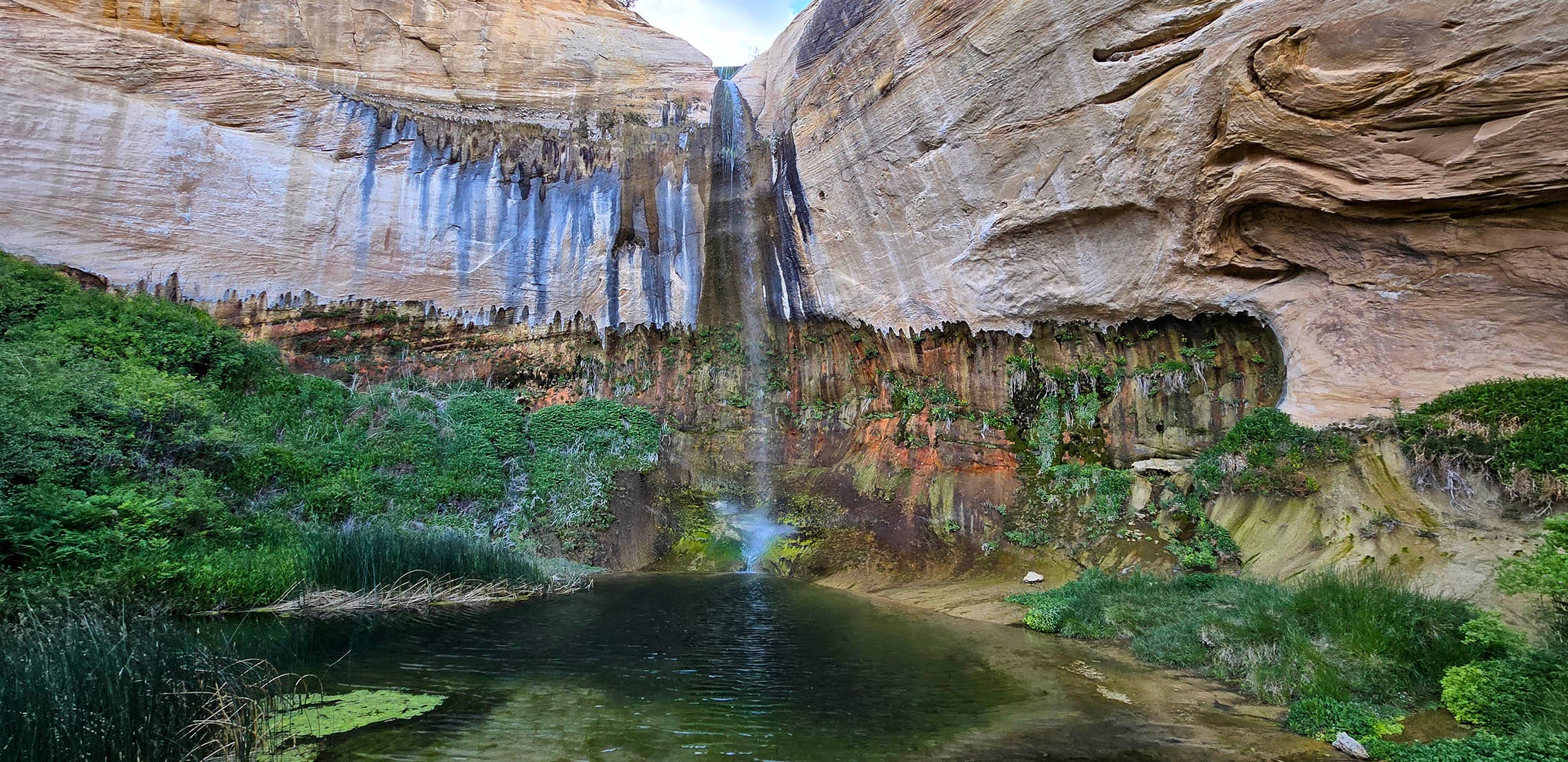
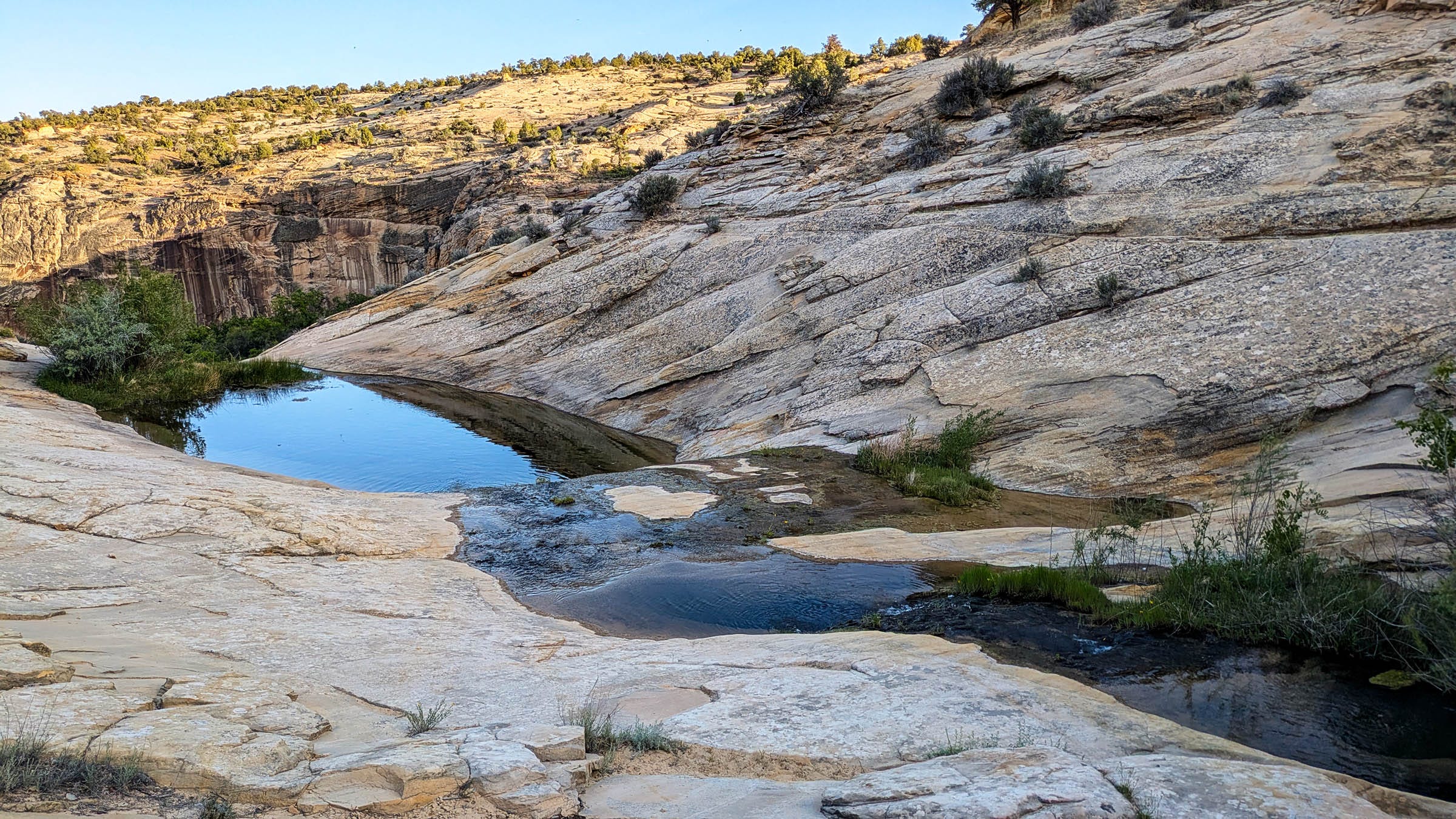
Soft splashing sounds of falling water play melodic vibrations within earshot. Thick 8-foot-tall patches of pink, blooming wild rose bushes grow over the trail. Lingering heat captures their intoxicating fragrance. The pinched path down opens onto a muddy, seep-wet ground sprouting sprigs of grass, reeds, and small bushes. There is no well-worn path to the small pool beneath the 88-foot waterfall. Taking another approach to get closer brings us to a very healthy patch of poison ivy, avoidable if one steps carefully, but again, any opening to get closer to the falls presents a challenge. Rock colors behind the falls display reds and browns with white streaks of lime leaching stripes across the wall. Hanging ferns and plants grow out of wet crevices. The water looks crystal clear. Swirled rock indicates ancient movements of sand. To see water gather and emerge out of miles of barren stone, having traveled a great distance from the mountains, poses a sense of the miraculous. Somehow water finds a way, persistent, penetrating patience.
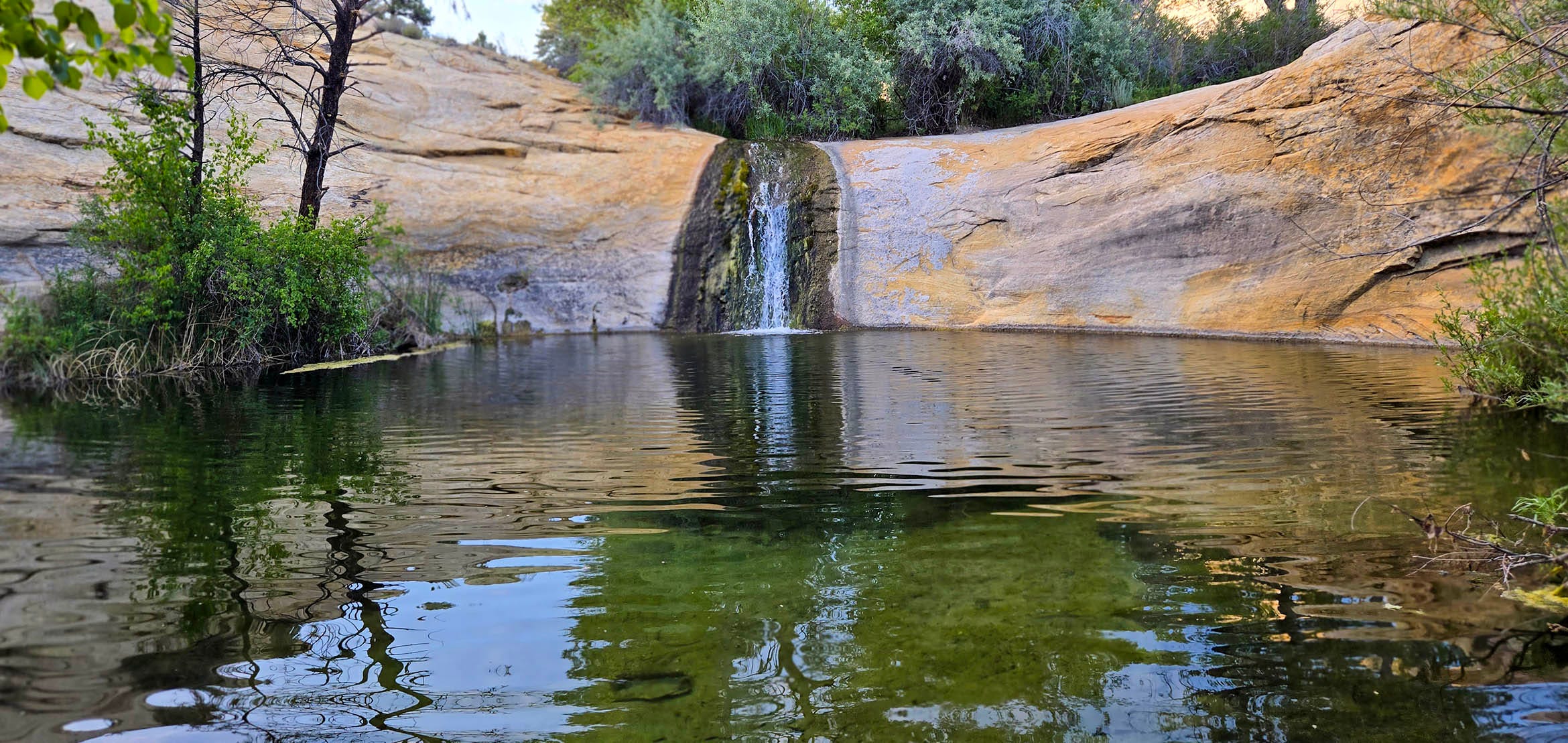
With time moving closer to sunset, we climb up to the other trail to catch sight of a series of shallow pools above the precipitous drop. During the hottest part of the day, overheated hikers frequently take a dip to cool off. We count 3 pools, each with a gentle current that presents no danger. Reflections capture sky in these oasis bowls. Cliff shadows lengthen across stone. We would like to investigate further upstream, but it is getting late, and the trail back up is not exactly well-marked.
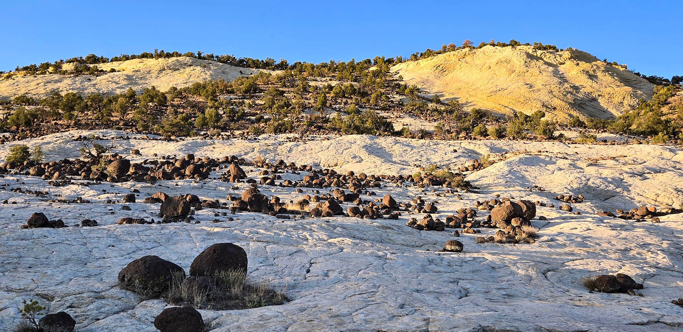
This is the perfect time to hike out, as the day cools down. The sun drops lower, and a light breeze rises. Bob and I wet our shirts for the climb up the vertical pitches of rock and sand. As we climb higher, the sunset rises with us, shade below, sun still shining above towards the top. We pass through a section of black basalt boulders that resemble bowling balls. I can’t say why I didn’t notice them earlier, but here they lie, scattered about in sharp contrast to the smooth white rock surface. Bob recalls reading how these round, volcanic shapes were carried by glaciers to this resting spot. They are amusingly odd.
We arrive at the van by 8:00. No one else remains at the trailhead. The quiet isolation encourages us to stay here, away from the more crowded, paid-for campground. From our parking spot, vistas of white-capped sandstone stretch into a spectacular pastel panorama. Night birds chirp their last evening phrases as a gentle breeze wafts still warm air up from the the day’s sunbaked rock. Planets and stars appear in a darkening, unobscured night sky.
Wow that was a hike worth waiting for