
Wandering Wonderland
Take a Walk through Bryce Canyon

For someone most comfortable in the isolation of wilderness: river canyons, high mountain lakes, or in search of hidden desert ruins, entering the Visitor Center at Bryce Canyon overwhelms my nervous system. It teems with people crowding between souvenir aisles of hats, t-shirts, mugs, stuffed animals, books, magnets, maps, water bottles, and more knick-knacks than you can imagine. Lines form for bathrooms, cash registers, and information personnel. Bob and I figure out where the hike to the Queen’s Garden begins, hoping there will still be a parking spot available, since the info agent had tried to convince us to use the shuttle bus.
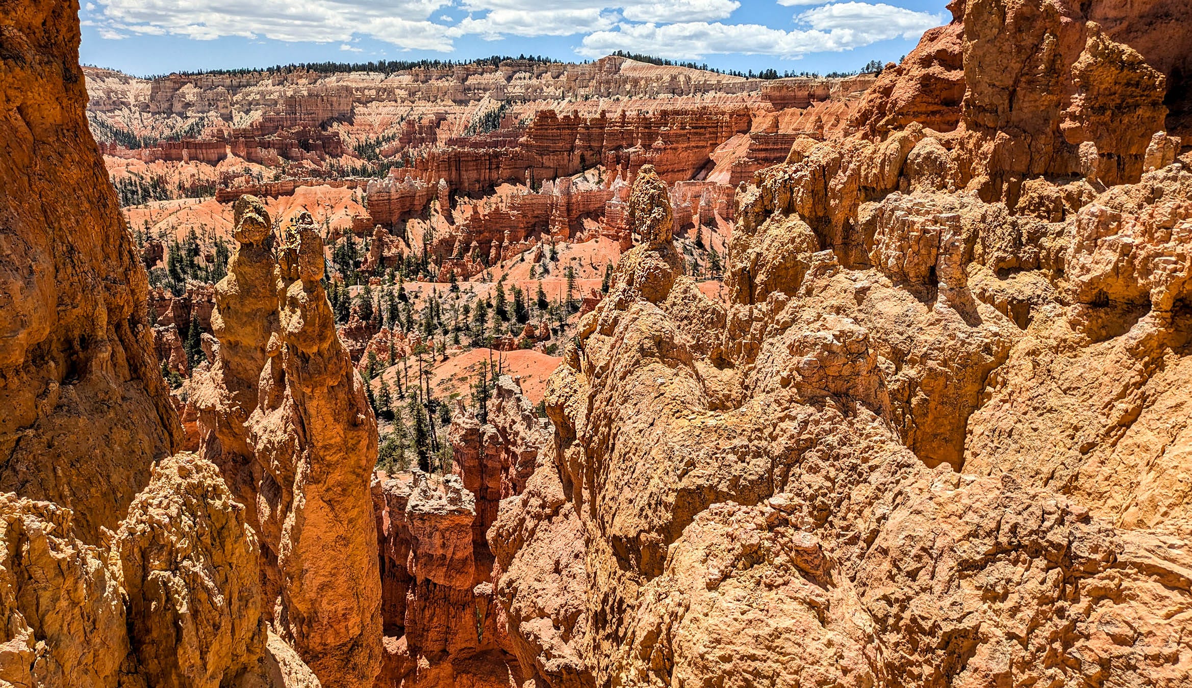
The overlook walkway leads up to Sunrise Point, where the fairly steep 625-foot descent to the Garden drops into a fantasy world of hoodoos, spires, parapets, arches, walk-through doorways, and bridges. Red and white sandstone and limestone formations resemble candle dripped, wax layers sloughing over each other, or maybe soft-serve ice cream cones, or perhaps the inspiration for minarets, tapered spikes reaching into sacred skies. Shape after shape grabs our attention, to the point where we often lose any sense of being surrounded by other visitors. Of course, fewer people leave the easy 5.5-mile overlook path to venture down into the Canyon. Our planned route combines Queen’s Garden and Navajo Loop for a 2.9-mile hike. A cold front has brought temperatures here to the mid-70s, but there is little shade on the thin ribbon of a path along this sun-drenched first half of the journey through the Bryce Amphitheater.
Descriptions and photos can’t really convey the extraordinary uniqueness of wandering through so many bizarre shapes. Freeze-thaw cycles called ‘frost wedging’ create vertical cracks poised to crumble. Chemical weathering, where snow, rain, and air mix to form carbonic acid, which then reacts with the limestone calcium carbonate, steadily dissolves the soft earth structures. Each turn in the narrow pathway reveals spectacular pedestals and columns, and balanced, rock hoodoos in ridiculous combinations and sizes.
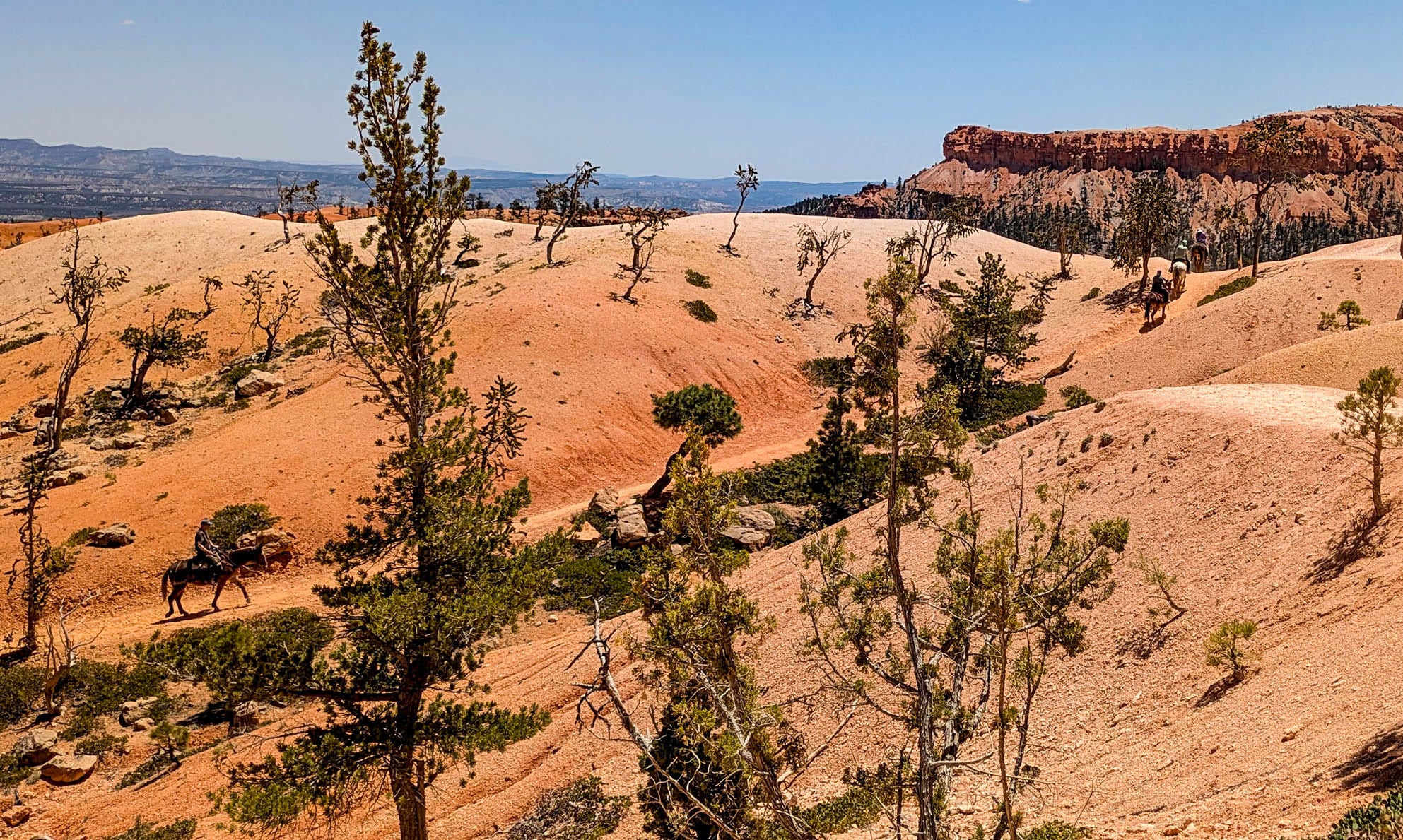
Partway down, a group on horseback rides a trail parallel to ours. One by one, the horses and mules cut through what looks like sparsely vegetated sand dunes before disappearing out of sight. Seems like an excellent way to experience the sights without as many people, quietly feeling the steady rhythm of four-legged steps.
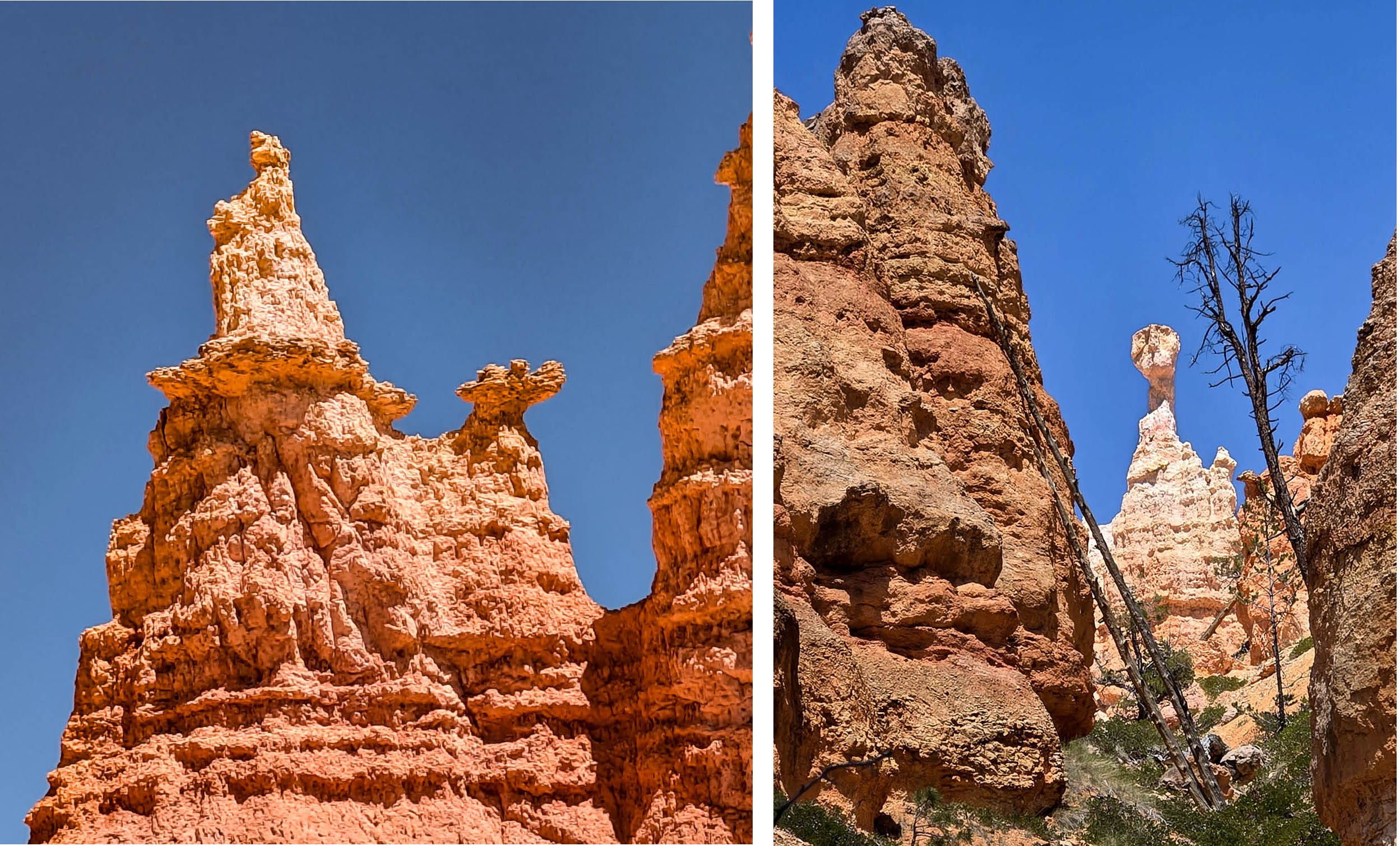
Halfway through the canyon, a side loop guides us to a formation called Queen Victoria, the obvious namesake of this hike. A photo of the actual Queen Victoria is on display below the white limestone statue to make sure you ‘get’ the resemblance. Naming hoodoos reminds me of children claiming clouds as elephants, or horses, or dragons. Bob swears one looks like ET, and he is more than happy to point out the exact details.
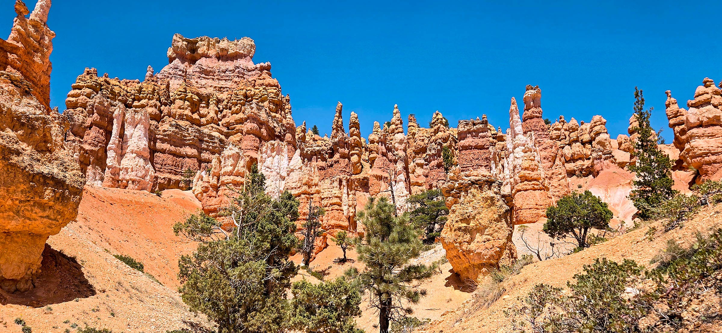
In this changing zone, bigger trees appear: Ponderosa Pine, Pinyon and Juniper, Douglas Fir, and Gambel Oak, the typical species you would see at 8,000-foot elevations. The shade is welcome in this hottest part of the day. The trail continues its descent as the terrain dishes out, spreading toward the base of the canyon. The dry sandstone sculptures become fewer in number. Soon, the route splits into 3 different directions. One trail continues toward the Peek-a-boo Loop, which adds another 5.5 miles to the hike total. Two other paths make up the Navajo Loop, which offers us a choice for the walk out. One ascends .6-miles to Two Bridges before reaching the rim. The other climbs .7 miles through an area known as Wall Street. Continued shade would be nice, but we don’t really have a clue which way will better shield us from the sun. Having spied a description of the Wall Street slot, we choose to go in that direction. The forested trail passes several sections of sandstone pinnacles and fissures, which feel closer and more accessible.
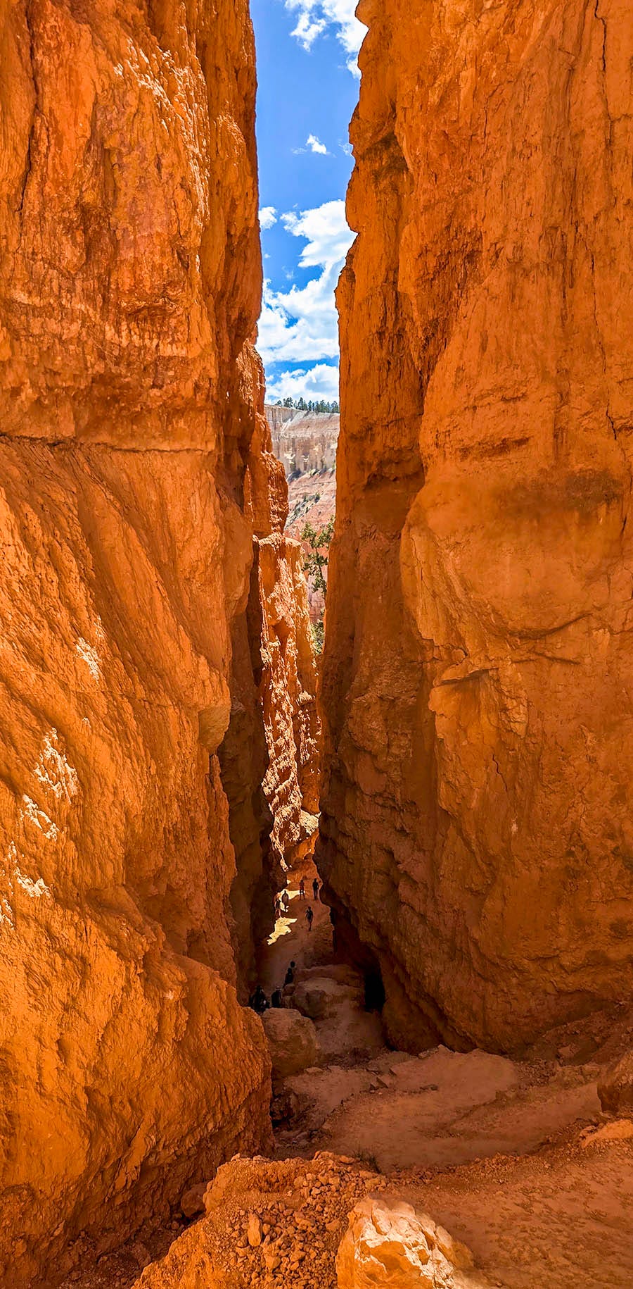
Perhaps if we had spent more time in the overcrowded Visitor Center, we would not be so surprised to see the 550-foot slot walls that drop from the rim to the canyon floor. The air noticeably cools in the dark shadow of the tight, crimson sandstone slit. A certain reverence fills the hushed atmosphere. I feel incredibly small. Refreshing breezes ease between the straight vertical walls, inviting us to linger. We hear voices speak Japanese, French, Italian, a Slavic dialect, and one from India. People traveling from all over the world have been drawn to this American marvel.
Now visible lie a series of almost 20 intensely steep switchbacks held in place by hand-hewn rock bricks and pressure-treated lumber poles. Only a few weeks earlier, this upper section of the trail was closed to the public by a landslide. As we rise out of the slender channel, the slot canyon opens up to more sun. Thankfully, one side of the switchbacks is in shade. At this time of day, one side of the switchbacks is in shade, creating frequent, cool breaks on the challenging climb to the rim. Returning to the more civilized cement walkway on top, a super-friendly Search and Rescue fellow welcomes us in a congratulatory way for our achievement in making it up the steep pitch. He also tells us about a little-used campground at Tropic Reservoir about 10 miles away. But that is a story for another day.

One DOES look like ET!