
Welcome to Cedar Mesa
From High Cliffs to Low Waters

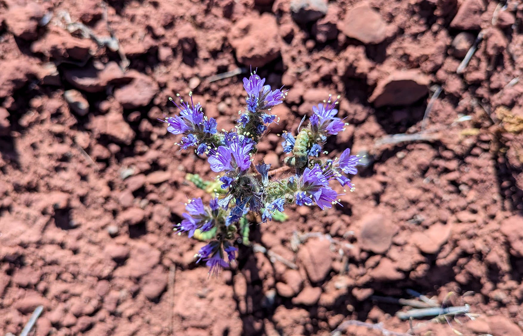
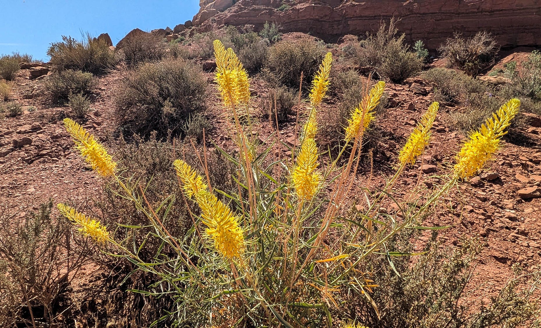
Morning in the Valley of the Gods reveals sunlit formations previously obscured by yesterday’s wind-stirred haze. Now, still air falls into the spaciousness of this sage-colored expanse, creating a kind of quiet that sucks any mental chatter from the mind as if placing it in a vacuum. Not even birdsong breaks the stillness. Eroded rock buttes and pinnacles stand silently motionless, resisting frequent shifting sands. Green ephedra bushes are the dominant vegetative feature dotting the reddish-brown dirt floor. Purple scorpion weed blooms decorate the tips of the curled plant, forming seedpods from earlier blossoms. Their season is almost over. Less frequent yellow prince’s plume and white wild buckwheat flowers add to the desert garden.
As the sun rises higher, breezes begin to stir, cooling the heated air. A raven streaks across a spotless blue sky. Flies stir. A single unseen songbird trills somewhere near a fallen pile of stone. Cars begin to travel the dirt road, leaving dust trails hanging in their wake. Time for us, too, to leave the monuments of gods, generals and chickens. The dirt road through the valley hits pavement only briefly before turning back to dirt. We approach the Moki Dugway, although the 1200 feet of steep sandstone walls completely camouflage the sight of any path. Narrow switchbacks climb for 3 miles, offering increasingly breathtaking vistas of where we have just been. Without guardrails, the sheer drop-offs demand Bob’s focus on the rough-cut road. How people even imagined creating a passage through solid rock is a testament to man’s persistence and engineering fortitude.
From the top of the Moki Dugway, the first dirt road turns left and travels 5 miles to Muley Point. We think there was a sign at one time, but today there is no indication of where it leads. In dry weather, a wide, somewhat washboard dirt and sand route provides an easy, relatively flat access for 2-wheel drive, low clearance vehicles. However, be warned, if muddy, the surface can become a greasy, slippery challenge even for 4-wheel drive. The road dead-ends at several overlooks. We stop at the first pullout onto the slab rock parking spot, Muley Point East. As we close the door to the van, the phone rings. My son, Eryn, wishes me a Happy Mother’s Day. Great timing since we have been out of phone range for the past 14 hours. We share the view, sending him photos, all the while wishing our family still took trips like these together.
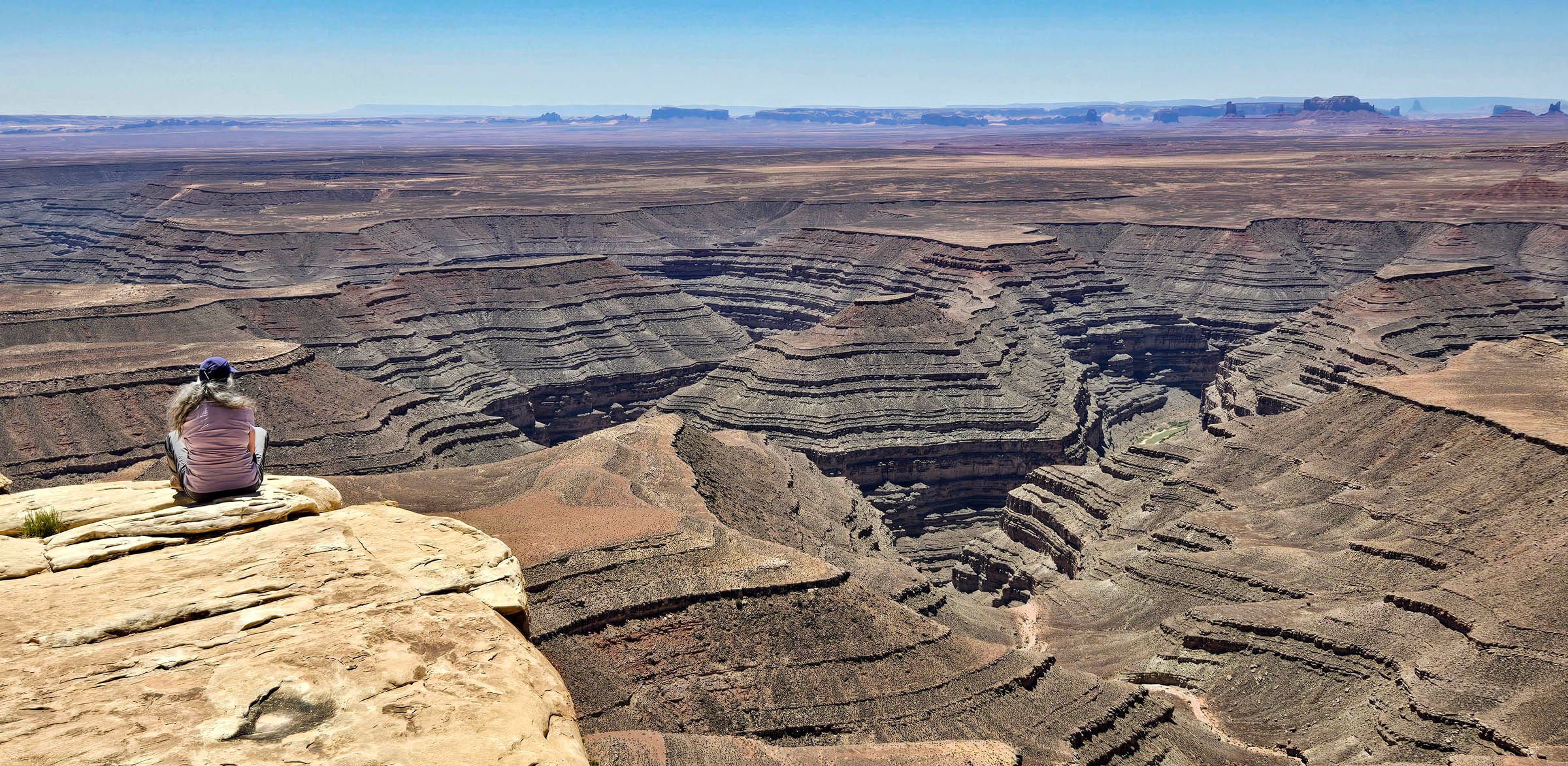
Wind blasts up the 1400-foot drop. To sit on the edge of geologic time with its sculpted, tiered ledges turned into water-worn horseshoe bends and goosenecks is otherworldly, beyond concept. A harder white rock layer caps the red cliffs’ sheer walls. Below, softer debris sloughs toward more scalloped layers that eventually lead to the San Juan River, barely visible as a blue-green sliver, that brings a spot of life to this otherwise desolate landscape. A thread of a dirt road follows precariously close along a shelf a few hundred feet below us. It heads towards John’s Canyon for thrill-seeking 4-wheel drive enthusiasts.
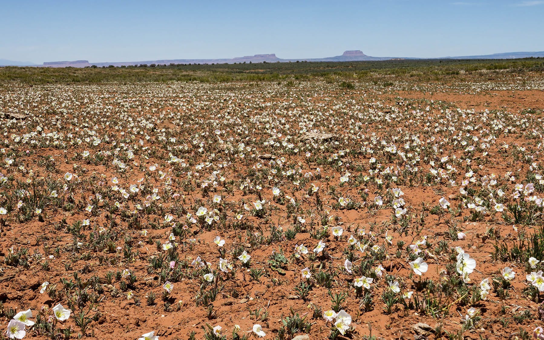
Returning to the main road, we notice fields of primrose missed on the drive in. Their delicate white-petaled blossoms grow close to the ground, waving in the wind. Yesterday’s flowers have wilted into faint pink, soft tissues resembling silk. Scattered cattle graze nearby.
Today is a long travel day. Highway 261 heads north across Cedar Mesa through Bear’s Ears National Monument before intersecting Highway 95 near the turnoff to Natural Bridges. We have explored this area with its many ruins and ancient sites in years past. The White Canyon’s deep chiseled channels and side canyons dictate the direction of travel toward Hite, Utah. The road to the Hite Marina and Lake Powell is closed. The boat ramp is nowhere near the water. The turnoff to Glen Canyon is also closed. We cross the Colorado River by bridge. The river has more water than the last time we passed this way, when it looked like a ditch. From the Flaming Gorge Reservoir in Wyoming, water is being released in an attempt to keep Lake Powell from falling below operating levels for hydro-electric power production. The lake has fallen to 22% of its capacity. Even worse, these low water levels are getting closer to reaching ‘dead pool’ where the river can no longer flow through the Glen Canyon Dam, essentially preventing any water from reaching the Grand Canyon. Even with the boost from the Flaming Gorge, we drive past miles of fingers of land that used to be underwater. Parched tamarisk flats line the dry river basin. The prolonged drought in the Southwest moves toward historical proportions.
With late afternoon approaching, we survey our camping options and discover we are near Goblin Valley outside of Hanksville, Utah. Looking for dispersed camping, we discover a description of Little Wild Horse slot canyon and make that our destination for tonight.
Lovely descriptions and photos.