
Buckskin Gulch
Longest and Deepest Slot Canyon in the World

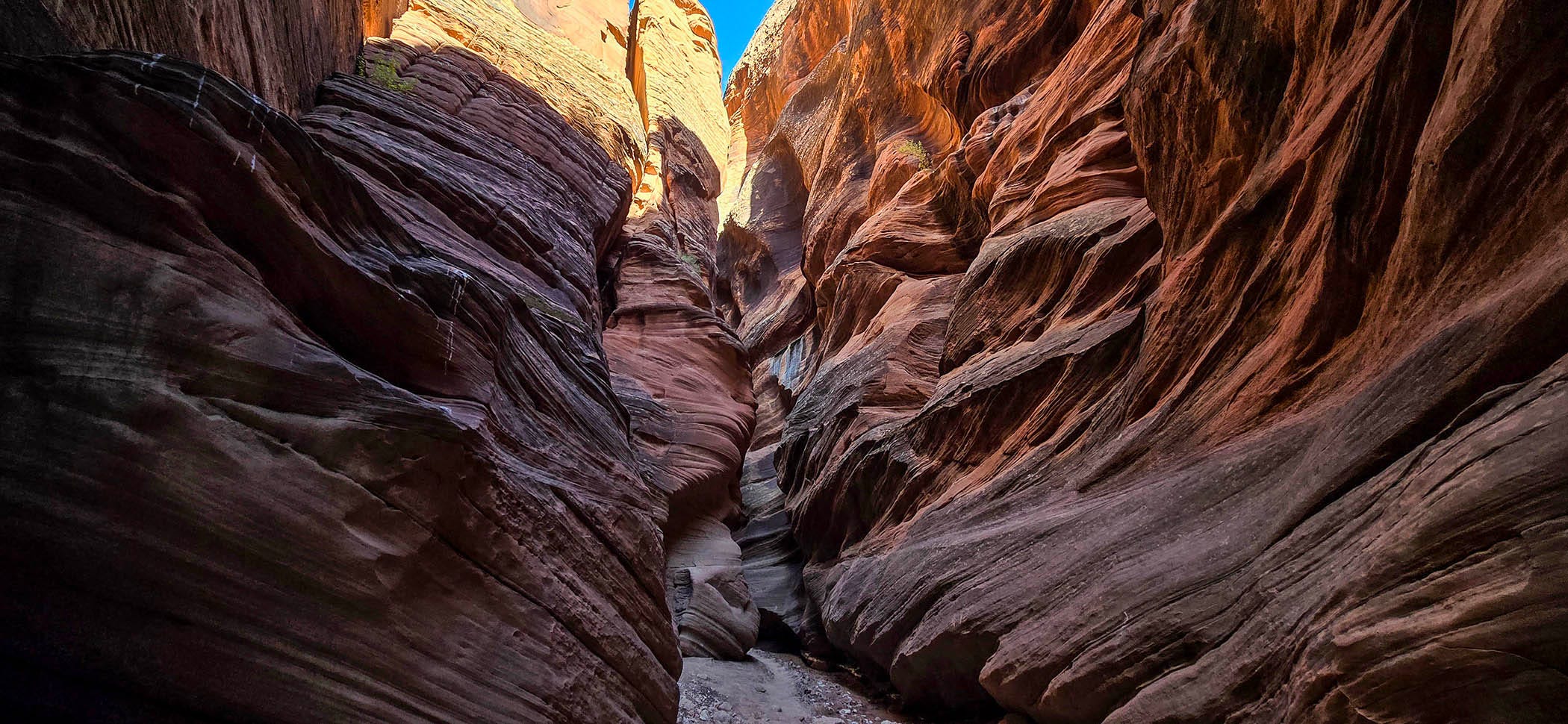
Traffic on Highway 89 pushes us down a long, curving hill at 60 miles an hour. Bob and I are looking for the House Rock Valley dirt road that leads to Wire Pass. The turnoff comes up fast at another sharp bend in the road. It is not very well marked. I am telling myself, ‘no sudden moves’, as vans are not known for their agility. Luckily, the entrance to a large parking area gives us room to get out of the way of the hurried drivers behind us. I take a deep breath and drive down to an information panel that confirms our location. Details include a map, geological descriptions, Emergency numbers, and a large section listing the many ways ‘YOU are Responsible for Your Own Safety.’ A picture of Buckskin Gulch describes how it passes through 16 miles of continuous slot canyon, making it the longest and deepest in the world.
Compacted red sand, clay, and rock form the 9-mile road to the trailhead. Warnings declare the road impassable when wet. Even 4-wheel drive vehicles have been known to slide sideways off the greasy surface. Today, the skies are cloudless blue, with clear weather predictions for the rest of the week. We should be good to go. Washboards shake and rattle every inch of the van, demanding a slow pace. The high-desert terrain wanders through sparsely vegetated land. Eroded red sandstone ridges shape drainage veins where water travels the paths of least resistance. While the road is fairly wide, channels have washed away soft shoulders, leaving deep drop-offs that need to be avoided.
It’s 1:30 and getting hot. We are surprised that 2 women meet us at the Wire Pass trailhead parking lot to point out new paid permit kiosks. There must be 30 vehicles occupying spaces. Obviously, this location in the Grand Staircase - Escalante National Monument has attracted quite a few visitors. We decide to check out the State Line Campground, a mile further up the road. Whether a site is available or not will determine our options.
All 8 campsites are available. We do a lap around and pull into the first one. One thing we have learned on this desert trip is that you don’t have to hike in the hottest part of the day. We pull out our camp chairs, have lunch, and take a break, waiting for a later start. At 4 o’clock, we head to the trailhead and pay our $6.00 per person permit fee. FYI, the fee for dogs is also $6.00 each. The parking lot still has 20 or so vehicles lined up, side by side. A second popular draw here is named ‘The Wave’, a demanding 6.4-mile round-trip hike that circumambulates swirled, dune-like rock formations. Permits are accessible by lottery only. It must be pretty special for people to climb the reflective, tan slickrock trail in this heat. Instead, we will search for cast shadows from towering slot canyon recesses.
While I thought the Wire Pass slots would start sooner, it turns out the trail runs through a mile-and-a-quarter-long, flat wash still being baked by the sun. Occasional breezes help moderate the heat and minimize the number of flies buzzing around us. At least the footing is firm to walk on, instead of the deep sand we have grown accustomed to on so many of our previous outings this last week. A small group of 20-somethings plods ahead of us. Slowly, they drag themselves from one shady rock outcrop to the next. Their continuous, chattering voices loudly fill the vacant space. One carries a 5-foot-long pole, awkwardly topped with a GoPro camera that waves from side to side. We quickly outpace them, wondering how far they will get.
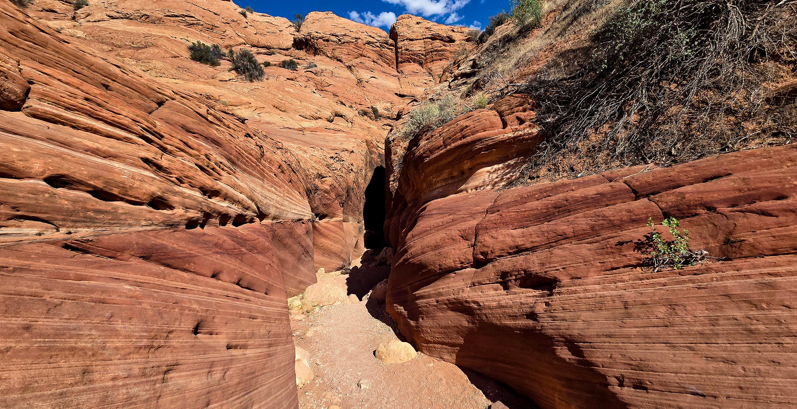
Gradually, the arroyo begins to taper. A marker signals the turn-off for Coyote Buttes and the Wave. Multiple signs tell us to stay in the wash. Various shortcuts tempt us to bypass the extra distance created by the circuitous route dictated by water meandering through the sandy gully. But it seems wiser to follow the rules, so as not to miss the entrance to the Wire Pass Slot.
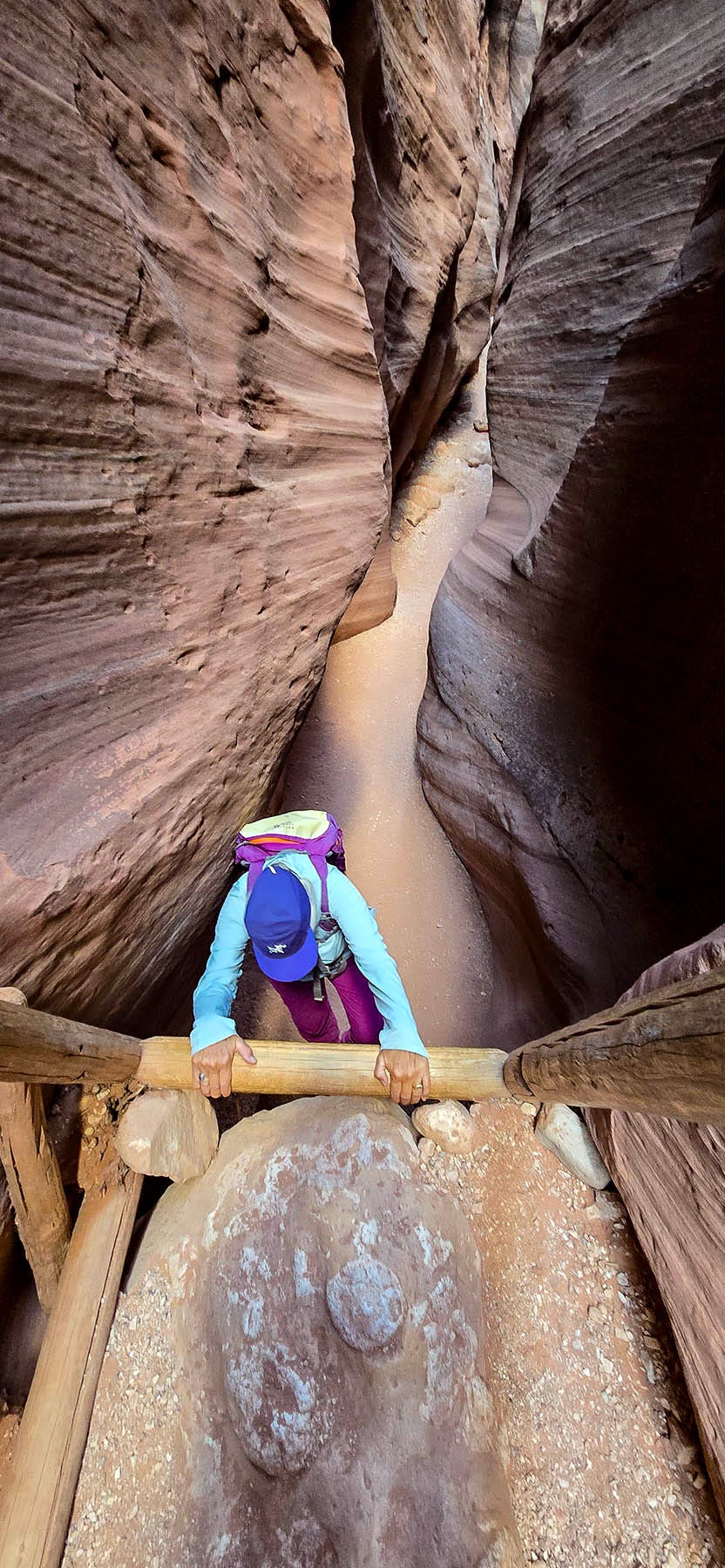
The first slot heights reach about 30 feet tall. A 3-foot-wide wooden ladder snuggly tucks between the 2 walls and takes us down a 10-foot drop. The poles are smooth to the touch as if rubbed down by the frequent contact of fellow travelers. The polished texture evokes images of previous ladder-goers, climbing to reach otherwise inaccessible cliff dwellings. Intact ladders can still be observed at ruins where they were hauled up to keep families safe from marauding tribes.
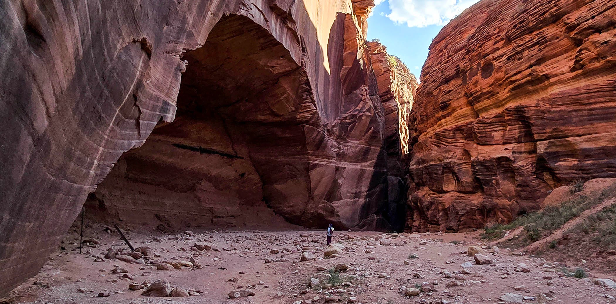
This initial fissure is kind of a fake-out as the drainage widens, continuing in the open a bit farther before a second slot closes around us. Now, red sculpted walls turn a darker hue in tight, sinewy spaces. The soft sand alley weaves through passages a few feet wide, before once again breaking into a broad sunlit area that intersects the main attraction of Buckskin Gulch. To the right, a large vertical red facade, stained with desert varnish and a carved arch shape not yet cut through the rock, marks the junction. A petroglyph panel of bighorn sheep displays several large animals drawn under a pecked-out, undulating, snakelike pattern that some interpret as a path the ancient people traveled. A row of smaller bighorn appears at the base of the wall under the larger sheep. These faint forms are difficult to make out, having been worn and scrubbed by the exposure to flash floods over hundreds of years.
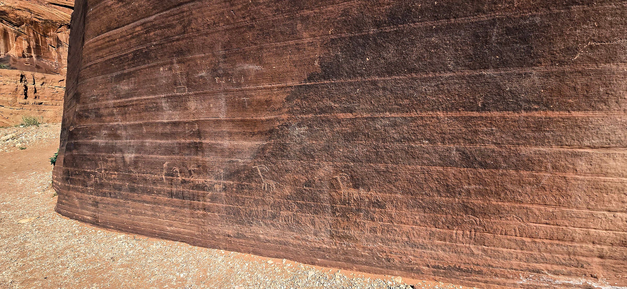
We have repeatedly been advised to take the right fork. The left one leads to the dirt road we drove in on, near the west end, where Buckskin Gulch begins. The right fork travels the majority of the 16-mile distance, where it eventually meets the Paria River before continuing down to Lee’s Ferry.
The canyon floor of Buckskin Wash is unexpectedly packed full of small boulders, or as Bob puts it, large cobblestones. Many are embedded in the sand, their surface tumbled round by water abrasion. Many are less stable, unpredictably rolling away underfoot. Loose sand adds to the stones’ slippery nature. Our shoes slide between rocks more frequently than anticipated. The challenging terrain demands attention to where we place our feet. The walls are remarkably taller than anything we have been in, up until now. Places reach unobservable heights of 500 feet. Carved, sculpted, winding corridors lead past striped rock faces and spiraling alcoves. Deposited by massive floods, logs hang suspended 60 feet in the air, where they are wedged between the two sides. Sticks reside smashed into gouged pockets 30 feet high. Fins protrude. Sluices slide. Cracks create dark, creviced recesses. Corkscrew coils resemble wormholes. The fantasia of this place draws us deeper into silent awe as the track leads on and on within the shaded maze. Blue sky and sun barely form a crease of penetrating color. Stagnant mud puddles press against hollowed-out sandstone bases. They record deep imprints of human, dog, and equine passersby. Hoofprints and aging horseshit provide undeniable evidence of horse travel down here. Perhaps wild horses have wandered into these shaded trenches seeking relief from the blistering sun. Is it possible that guides have led tourist-laden animals along this route? Surely, pinched, serpentine turns would bang the knees and shoulders of mounted riders. As I slip and stumble my way down the boulder-strewn pass, I conclude I’d never take my own horses into this treacherous, leg-breaking terrain.

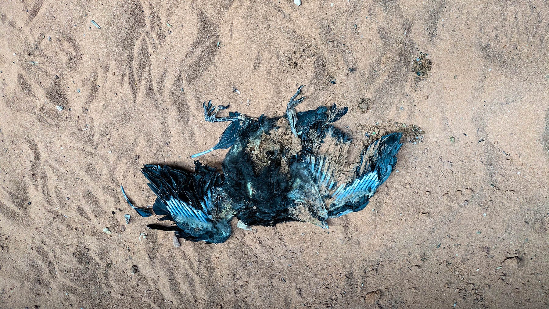
The trail to the intersection of Wire Pass and Buckskin canyons measures 1.7 miles, as the crow flies. Yet this trail has been anything but straight. We guess we have traveled another mile and a half beyond that. The GPS fails to register mileage. The plunging depths block any consistent location abilities of satellites. Our turnaround time is set for 6 o’clock. At 5:40, the canyon bottom finally turns to sand, encouraging us to continue further, on the easier footing. A pair of young Japanese fellows strides up behind us, asking if this is the way to the Wave. Sadly, no. They missed that turnoff miles ago. We come upon a disintegrating bird skeleton. Outstretched wings resemble ancient fossils or perhaps an abstract art form. In another location, Bob says he smells something dead.
We reach our cutoff time just as a section of the chasm expands. Vegetation begins to appear, first as a thin line on an invisible shelf 20 feet from reach, a slit oozing moisture, seeping like gathered tears. Then bigger bushes appear. The slot turns into a sunlit park. Arched caves are littered with fallen slabs and chunks of stone. No longer cooled by shadows, warm breezes carry the heat of the day. 6:07, we pause where we are, satisfied we have gone far enough.
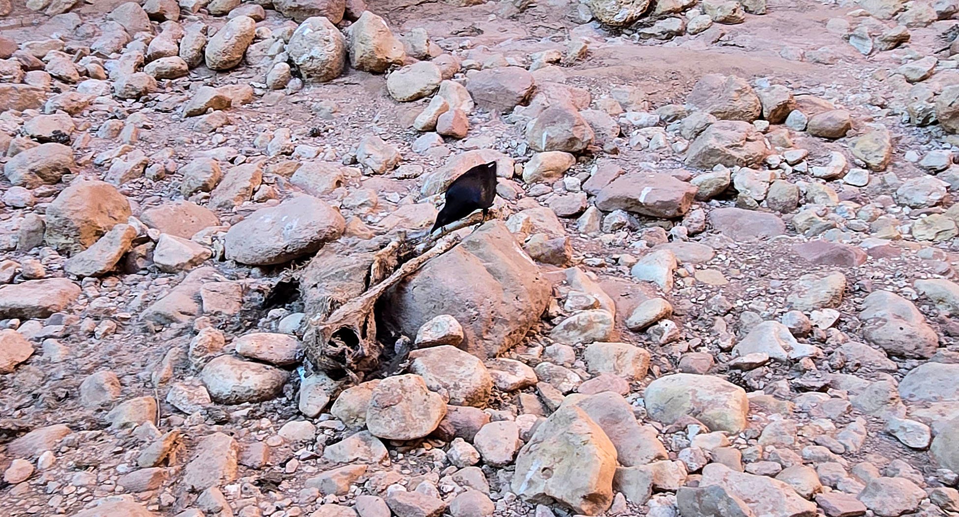
Back in the twisting narrows, the light changes, moment to moment, from dark places that seem to absorb all color to walls bathed in brilliant orange glows that accentuate every illuminated detail. Back near the sandy wash that turns into the piled-up boulders, a raven flies up canyon from behind us. It stops on a rock ledge, silently blending into the background. Bob squawks at it in his best raven imitation. Maybe the bird thinks he has a New Mexican accent. It works to communicate with the ravens at home. The large corvid flies ahead, flapping obsidian wings that echo swishing noises off the perpendicular-pitched slabs. Then, we reach the place where Bob suspected something had died. It is not a pile of sticks, but rather a deer carcass. We see 2 legs, some bones, and a little hide. The raven pulls pieces from it, bite-sized morsels. Slowly, it feasts, bit by bit, totally unconcerned about our approach. It refuses to give up this boon for a couple of non-threatening humans wandering past. Death and survival are wrapped into one.
Leaving the carrion feeder behind, I stop for a moment in the stillness to close my eyes, to feel into the rocky floor, my back pressed against solid earth. Wondering – would a flash flood start as a trickle, a tinkling warning of what is to come, a slight vibration, noticeable in my bones? Or does a raging, churning turbulence rush, all at once, in a violent torrent, backing up, pressurizing into squeezed places, quickly rising higher in the vertical tube? Only walls of this magnitude can withstand such power. I teeter on the edge of the imagined, predictable terror. If trapped, there is only one way out within a 16-mile distance. That would be something…not to be witnessed
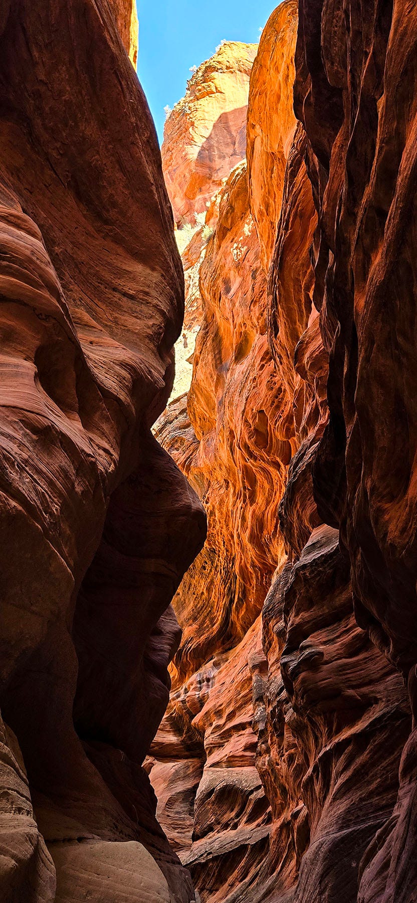
Onward we go past the Wire Pass – Buckskin intersection. The petroglyphs are barely distinct in this light. We haul ourselves up and over a couple of short 3 to 4-foot pitches, navigate around 2 logs that block the way, return to the laddered 10-foot ascent, and breach the entrance back into the open wash. Behind us, the splendor quickly slips into memory. It is now just past 7. At least the more expansive territory ahead rests in shade, as the sun sinks toward the horizon. We trudge our tired bodies the mile and a quarter back to the car.
Flies dine on the dead bugs covering the front of the van. Cedar gnats crawl all over the windshield by the hundreds. Gratefully, we return to our State Line Camp. One turn in the driveway is in Utah, the next minute it is in Arizona. Amusingly, one more bend and it returns back to Utah, all in less than an eighth of a mile. More folks have become neighbors. The campground looks full. The evening descends around us as we settle into this resting place. Tomorrow the road leads toward home.
Inspiration and gorgeous photos--thank you!
Breathtakingly beautiful, unbelievable photos!!!